70 Wild Miles
A charity triathlon;
70 miles, 1 day, 3 challenges.

|
70 Wild Miles |
|
|
| Glencoe | Supporters and competitors forum | Join us in Facebook |
| Home | Glencoe | The Event | Register | History | Results | FAQ | Supporters | Your Pictures | Your Comments |
| See the route in Google Maps. | ||
|
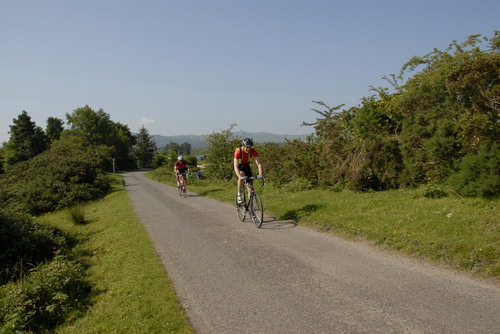
The Course…… Although the title of the event is 70 Wild Miles, I wouldn't take that distance as absolute gospel! As far as I know, nobody has actually gone out and measured the course distance accurately. And when you realise that the event was run over one course for the first six years, with the name being carried over to a course with a different Start and Finish, you will think that it should perhaps be called:- "Approximately 70 Wild Miles". The present course starts from the White Corries ski centre with the competitors assembling in the centre's car park for the cycling stage of the event. As this part of the event takes place over public roads, it is only sensible that there is no mass start and instead the competitors are sent off at timed intervals Southwards on the A82 road towards Tyndrum. As they pass through the often bleak and windswept, though scenic, length of Glencoe they may well appreciate why the event now takes place in early June. Sweeping down the hill on the final approach to Tyndrum they will be directed at its base onto the A85 road Westwards towards Taynuilt and the completion of the first stage of their exhaustive day.
|
||
| Once
at Taynuilt it's a rest stop until everyone
has arrived and is ready to begin the Canoe stage. For safety reasons this
part of the course is taken as a mass start with all the safety and rescue
boats in attendance. As Loch Etive is a tidal sea loch the weather is of
first importance and in fact in 1996 the weather was so bad that the
Canoe section had to be cancelled due
to
real fears for the competitors safety.
|
||
| Times for each running of the event are only really relevant to that year, due to the variations in conditions depending on the weather, And nowhere on the course is this more true than on Loch Etive. You might think that after this excitement the kind organisers would have had pity on the poor competitors and arranged a nice gentle run to the finish. Not a chance! The run section of the course has most of its length lying at angles, which would have mountain goats looking for an easier path (perhaps a light exaggeration?). The chief difficulty, however, is the fact that the course runs along a single lane road, which is the only access for the head of the loch. Thus the runners - especially those towards the end of the field - have to deal with traffic carrying spectators, organisers and eventually canoes in often-overloaded trailers! | ||
 |
 |
 |
 |
|
The Cycle. You may notice that there is no picture of the cycle route here. This is not accidental! We have no desire to scare off any prospective entrants before they begin or urge certain individuals to check the coverage of their whole life insurance plans. As has been stated the cycle course is about 47 miles of public road, unfortunately this road can, at times, be quite busy with fairly fast moving traffic. The good news is that it has good visibility for almost all the length of our course giving vehicles plenty time to see the cyclists ahead and pick safe places to pass - the bad news is that the same open nature of the road means that if we are unlucky enough to have bad weather on the day the times for the section can be quite unpredictable. Thanks to Gordon Gooch we are now able to show the profile of the cycle course (right), the good news is that from start to finish it's 917ft. downhill - the bad news is those climbs, especially the long drag up before the descent to Tyndrum. Incidentally, the readout for Gordon's cycle also provides details of temperature, time etc. - but as this run was undertaken in mid-December with Gordon giving his imitation of Nanook of the north (see picture below), we thought that these details might be slightly irrelevant!
|
 |
|
The Canoe. Loch Etive is the site of the canoe section of the event, a beautiful (on a clear day) sea loch which lies, not surprisingly, in Glen Etive in the western highlands of Scotland. This is a tidal water so it is advisable to arrange for a suitable vessel for the conditions likely to be met here. |
 |
|
The
Run.
The map below shows the course of the final run section of the event, what it can't really show is the rise and fall of the single track road that makes up the course. To give an idea of that, one of our more “intrepid” (translation = masochistic!) organisers decided to go up to the course in deepest December and ride the course using a “trick bike computer” to obtain the course profile shown left.
|
 |
 |
|
 |
The cyclist in question is pictured here, modeling the latest design for winter touring in Glencoe - this is one more reason why the 70 Wild Miles event is held in June! I don't think I could do better than to end with a direct quote from the message which accompanied the profile. “In deepest winter this week and armed with my trick bike computer I f*£$$*^g toiled through icy headwinds, snow and rain to bring you the attached!! (For reasons I will not go into the first attempt at the cycle had to be aborted after 22 miles just after the 6 mile climb to Tyndrum had been completed in a near blizzard!!!!) ” |
| A sincere vote of thanks is due for devotion, above and beyond the call of duty! | |